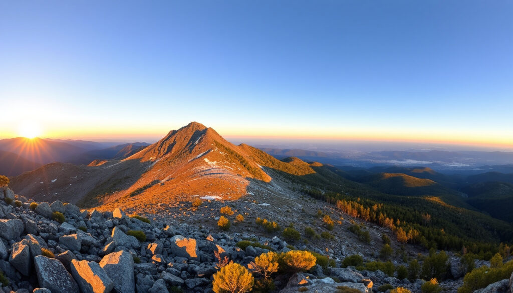
Mt Bogong Hike: Trails, Camping & Tips for Victoria’s Highest Peak
Few mountains in Victoria capture the imagination quite like Mount Bogong. Rising to 1,986 metres, it’s the state’s highest peak and a rite of passage for hikers who want a genuine alpine challenge without leaving the state. This guide pulls together the key details you actually need — trail comparisons, camping rules, and safety logistics — so you can plan a summit that’s both ambitious and smart.
Height: 1,986 m (6,516 ft) ·
Elevation gain (Staircase Spur): ~1,200 m ·
Round trip (Staircase Spur): 20 km ·
Typical duration: 8–10 hours ·
Difficulty: Hard ·
Location: Alpine National Park, Victoria
Quick snapshot
- Peak height measured at 1,986 m (Parks Victoria, the state park authority)
- Official name Mount Bogong (Parks Victoria)
- Pronounced BOH-gong (Wikipedia, the open encyclopedia)
- Part of Alpine National Park (Parks Victoria)
- Current snow conditions and trail closures vary by season — always check Parks Victoria alerts before setting out.
- Exact number of hikers per year is not publicly tallied.
- No active timeline events recorded; the mountain is a static natural landmark with seasonal access windows.
- Check Parks Victoria’s Alpine National Park page for up-to-date trail conditions, weather warnings, and park closures.
Mount Bogong is Victoria’s highest peak by a clear margin — 1,986 m — but its real challenge is the 1,200 m of vertical gain on the Staircase Spur. For day hikers, that means a 20 km round trip that tests both legs and lungs.
Here is a quick reference for the key specs you need to know before planning your hike.
| Attribute | Value |
|---|---|
| Height | 1,986 m |
| Location | Alpine National Park, Victoria |
| Nearest town | Mount Beauty |
| Trail length (Staircase Spur) | 20 km return |
| Elevation gain | ~1,200 m |
| Typical time | 8–10 hours |
How Hard Is It to Climb Mount Bogong?
What factors determine the difficulty?
- Elevation gain: The Staircase Spur route climbs roughly 1,200 m from the trailhead — that’s the equivalent of walking up 400 flights of stairs in one go.
- Distance: The return trip is 20 km on the Staircase Spur circuit, as listed on AllTrails, the community-driven hike database.
- Terrain: The track is rated Grade 3 by Parks Victoria — meaning steep sections, rough surfaces, and a need for moderate fitness and sure-footedness.
- Weather: Conditions can shift from sunny to snowy within hours. Hikers need to be self-sufficient with navigation, shelter, and layers.
How does it compare to other Victorian peaks?
Mount Bogong is about 370 m higher than the second-highest Victorian peak, Mount Feathertop (1,922 m, via Wikipedia). But the hike to Bogong’s summit is among the most accessible of the high peaks because the Staircase Spur trailhead sits at about 800 m, meaning a long but steady ascent rather than a technical scramble. For context, the Eskdale Spur route has a slightly lower total elevation gain (around 1,000 m) but still takes 7–9 hours.
How Long Does It Take to Summit Mount Bogong?
What is the fastest route?
- Staircase Spur: The most direct line, 20 km return, 8–10 hours. Parks Victoria describes it as a 16 km walk (likely excluding the vehicle track section) taking 10 hours return at Grade 3 difficulty (Parks Victoria visitor guide).
- Eskdale Spur: Slightly shorter (18 km return) and a more gradual gradient, but still a solid 7–9 hours. The two trails converge near the summit ridge.
- A four-day circuit of about 56 km is documented by Beyond Wild Places, an Australian hiking outlet, using camps at Bogong Creek Saddle, Ropers Hut, and Cleve Cole Hut.
How to pace yourself for a day hike?
Most experienced hikers start before dawn — by 5:00–5:30 AM in summer — to reach the summit before early afternoon storms roll in. The climb from Mountain Creek Picnic Area to the summit via Staircase Spur takes roughly 4–5 hours up, and 3–4 hours down. A good rule: aim to be at the summit by noon at the latest.
Can You Camp on Top of Mount Bogong?
Where are the designated campsites?
- Cleve Cole Hut — a bunk-style shelter near the summit, available on a first-come basis.
- Michell Hut — a basic shelter lower on the mountain.
- Bivouac Hut — located about halfway up the Staircase Spur, according to Parks Victoria.
What are the regulations for backcountry camping?
- Camping is free and dispersed throughout most of the park, per Parks Victoria camping rules.
- No camping directly on the summit — use established sites.
- Campfires are not permitted; use gas stoves.
- Camping must be at least 100 m from any hut site (200 m for Wallace’s Hut) and at least 200 m from waterways, roads, and designated picnic areas.
- Hikers should be self-sufficient with food, water, first aid, camping gear, and map-and-compass skills.
The catch: these rules are enforced, and breaking them can result in fines or restricted access.
The huts fill quickly during peak summer weekends. If you plan to rely on Cleve Cole Hut for shelter, carry a tent as backup. The 100 m camping setback from huts means you can pitch near the hut but not inside unless you’re early.
How Do You Pronounce Mount Bogong?
What is the correct pronunciation?
It’s BOH-gong — two syllables with the stress on the first (rhymes with “so long”). Wikipedia’s entry on Mount Bogong notes the pronunciation as /ˈboʊɡɒŋ/.
Why does the name sound like that?
The name comes from an Aboriginal language — likely the Dhudhuroa or Waywurru word for the bogong moth (Agrotis infusa, via Wikipedia), which historically migrated in vast numbers to the mountain’s caves and crevices. The moth was a traditional food source for Aboriginal peoples.
What Are the Best Trails for Hiking Mount Bogong?
Which trail is most popular?
- Staircase Spur: The most direct and steepest route, starting from Mountain Creek Picnic Area. It follows a vehicle track initially before the real climb begins. Parks Victoria describes the walk as 16 km (some sources say 20 km including the vehicle track) taking 10 hours.
- Eskdale Spur: A more gradual climb that avoids some of the steepest sections. It’s 18 km return and typically a bit faster (7–9 hours).
- Duane Spur and Granite Flat Spur are other options for multi-day circuits.
How to choose based on skill level?
The Staircase Spur is the classic “conquer the highest peak” route — hard, rewarding, and with the best “I earned this” views. Eskdale Spur is a better choice for those who want a slightly more forgiving gradient, though it still demands good fitness. For beginners, consider building up with shorter alpine walks first — like Roper Lookout (5 km, 1.5 hours, via Parks Victoria) — before tackling Bogong.
How to Prepare for the Mount Bogong Hike
- Check current conditions. Visit Parks Victoria’s Alpine National Park page for trail alerts, fire danger ratings, and weather forecasts. Snow can persist into November.
- Pack the essentials: At least 3 litres of water, high-energy food, warm layers (including a waterproof jacket), headlamp, map and compass (or offline GPS app), first aid kit, sunscreen, and a PLB (personal locator beacon) for emergencies.
- Choose your route. Know whether you’re tackling Staircase Spur or Eskdale Spur, and have a turn-around time written down. Let someone know your plan.
- Start early. Leave the trailhead by 5:30 AM in summer to summit before afternoon winds and storms.
- Follow park rules: No campfires, carry out all waste, camp at least 100 m from huts and 200 m from waterways. Parks Victoria regulations are clear and enforced.
What this means: preparation is not optional — it’s the difference between a rewarding summit and a dangerous situation.
Voices from the Mountain
“At 1,986 m, Mount Bogong offers a high-altitude playground for outdoor adventurers.”
— Parks Victoria, official visitor guide
“The name Bogong is derived from the Aboriginal word for a type of moth — the bogong moth — which was an important food source.”
— Wikipedia, Mount Bogong entry
Hikers routinely describe the summit as “Victoria’s front-row seat to the Alps” — a blend of pride and humility when the views stretch across the High Plains to the coast. If you’ve done the hard work to get there, the reward is real.
natgoeshiking.com, bushwalk.com, instagram.com, facebook.com, alltrails.com
For those interested in tackling another iconic summit, the Scafell Pike hiking guide offers a comprehensive look at England’s highest peak.
Frequently asked questions
Do I need a permit to climb Mount Bogong?
No permit is required for day hiking. Camping is free and permitted in most areas, but you must follow Parks Victoria’s backcountry camping rules.
Can I take my dog on the Mount Bogong hike?
Dogs are not allowed in the Alpine National Park to protect native wildlife.
Is there cell phone coverage on the trail?
Coverage is unreliable. Most carriers lose signal once you leave the valley. Carry a map and compass or a GPS device with offline maps.
What is the best season to climb Mount Bogong?
December to March offers the most stable weather. Snow can linger into November and return by April.
Are there toilets at the trailheads?
The Mountain Creek Picnic Area has basic facilities. No toilets on the trail.
How do I get to the Staircase Spur trailhead?
Drive to Mount Beauty, then follow Mountain Creek Road south for 14 km to the Mountain Creek Picnic Area. The road is sealed most of the way but the last section is gravel.
Can I park my car overnight at the trailhead?
Yes, overnight parking is allowed at the Mountain Creek Picnic Area car park. Leave no valuables visible.
Related reading
- Mrs Macquarie’s Chair – History, Location & Visitor Guide — another classic Australian landmark worth exploring.
- Airlie Beach Hotel: Location, Amenities & Seasonal Tips — base yourself for the Whitsundays’ outdoor adventures.
For first-time summiters, the choice is clear: prepare for a hard, rewarding hike, respect the park’s camping regulations, and always check conditions before setting out. Mount Bogong doesn’t forgive shortcuts — but it rewards preparation with one of Victoria’s best alpine views. The implication: respect the mountain, and you’ll earn the experience.
More related posts
 Chemi t Warehou e Caboolture – Hour , Phone & Addre
 Tim Matheson: Actor, Director, Animal House & Virgin River
 Ed Warren: The Real-Life Demonologist Behind The Conjuring
 Madelyn Cline: Age, Height, Boyfriend, Movies, Net Worth
 Pink Video Chat Review: Free Instant 1v1 Random Calls
 Bec Mafs: Relationship, Illness, Wealth & Updates (2026)
 Southeastern Queensland Storm: Current Status and Tracker
 Simon Helberg: Biography, Career, and Family Life